
Municipality of Montevista Barangays & Directory
Montevista, historically founded as Caumanga and later San Jose, is a third class municipality situated in the lush central valley of Davao de Oro. Created under Republic Act No. 4808 on June 18, 1966, Montevista serves as an essential agricultural hub and transit nexus linking the Agusan to Davao corridor with the provincial interior through National Highway AH26 and the Montevista Compostela Mati arterial road.
Heart of the Central Valley Crossroads
Geographic positioning, economic profile, and administrative overview of Montevista, Davao de Oro.
The Municipality of Montevista occupies a strategic expanse of 265.60 square kilometers (102.55 square miles) in the upper Agusan River drainage basin of Davao de Oro. Bordered by Monkayo to the north, Compostela to the east, Nabunturan to the south, and Asuncion and New Corella in Davao del Norte to the west, Montevista functions as a vital logistical crossroads connecting the provincial capital district with major agricultural corridors and eastern coastal arteries.
In the Philippine Statistics Authority (PSA) census, Montevista registered an official population of 46,558 residents across 20 distinct barangays, reflecting a population density of 175 persons per square kilometer. The town center in Barangay San Jose (Poblacion) represents the largest demographic and commercial cluster with 9,076 residents, followed by thriving agricultural communities in New Visayas (5,773), Linoan (4,184), and Mayaon (3,335).
Under the Department of Trade and Industry (DTI) Cities and Municipalities Competitiveness Index (CMCI), Montevista demonstrates outstanding developmental momentum among 3rd to 4th class municipalities. The municipality secured Rank 33 nationwide in Infrastructure, Rank 90 in Resiliency, and Rank 59 in Economic Dynamism, supported by comprehensive electronic business permitting (e-BPLS), computerized tax collection systems, and an integrated municipal road network.
Fast Statistical Profile
- Official Name: Municipality of Montevista
- Province: Davao de Oro
- Region: Davao Region (Region XI)
- Legal Charter: Republic Act No. 4808 (1966)
- Barangays: 20 Barangays
- Population (2020 PSA): 46,558 residents
- Land Area: 265.60 km² (102.55 sq mi)
- Coordinates: 7.7042° N, 125.9913° E
- Average Elevation: 82.9 meters (272.0 feet)
- Poverty Incidence (2023): 16.27% (Down from 48.75% in 2000)
- Postal Code: 8801
All 20 Barangays of Montevista
Filterable directory with verified census counts, geographical zones, and local economic characteristics.
| Barangay Name | Geographical Zone | Population (2020) | Share of Town | Notable Landmarks & Characteristics |
|---|---|---|---|---|
| San Jose (Poblacion) | Urban Poblacion | 9,076 | 19.49% | Municipal Hall complex, Montevista public market and integrated bus terminal, commercial center along Daang Maharlika (AH26). |
| New Visayas | Agricultural Valley | 5,773 | 12.40% | Second largest demographic center, major rice and banana producing plains, extensive irrigation networks. |
| Linoan | Agricultural Valley | 4,184 | 8.99% | Charter founding barangay under RA 4808, thriving cacao and commercial coconut plantations. |
| Mayaon | Upland & Highland | 3,335 | 7.16% | Home to Mayaon National High School (legislated under RA 9889), agroforestry and rubber processing. |
| Prosperidad | Agricultural Valley | 2,652 | 5.70% | Centrally situated agricultural district, diversified lowland farming and poultry cooperatives. |
| Tapia | Agricultural Valley | 2,612 | 5.61% | High productivity rice paddies, farm to market connecting roads toward Nabunturan boundary. |
| San Vicente | Riverine & Foothill | 2,274 | 4.88% | Growing residential and agricultural sector, riverbank flood control and corn farming. |
| Concepcion | Agricultural Valley | 1,777 | 3.82% | Vibrant rural farming community, cooperative drying facilities and grain storage. |
| Dauman | Upland & Highland | 1,711 | 3.67% | Rolling terrain, expanding cacao plantations, scenic viewpoints overlooking the Compostela Valley. |
| Camansi | Agricultural Valley | 1,573 | 3.38% | One of the six original charter barangays of 1966, commercial fruit trees and banana cultivation. |
| Bankerohan Sur | Riverine & Foothill | 1,473 | 3.16% | Original founding barangay along river basin, lush riparian vegetation and freshwater aquaculture. |
| Banagbanag | Agricultural Valley | 1,358 | 2.92% | Agricultural settlement, active community agrarian reform projects and vegetable farming. |
| Bankerohan Norte | Riverine & Foothill | 1,356 | 2.91% | Northern riverine sector, charter founding barangay under RA 4808, alluvial farming soils. |
| Canidkid | Agricultural Valley | 1,331 | 2.86% | Lowland agriculture, integrated multi crop family farms and local primary school. |
| Lebanon | Upland & Highland | 1,206 | 2.59% | Upland agricultural barangay, coffee cultivation, indigenous Mandaya community settlements. |
| New Calape | Agricultural Valley | 1,061 | 2.28% | Named by Boholano pioneer settlers, extensive corn production and cattle grazing tracts. |
| New Dalaguete | Upland & Highland | 1,036 | 2.23% | Named by Cebuano migrants from Dalaguete, vegetable and root crop terraces in cooler elevations. |
| Camantangan | Riverine & Foothill | 973 | 2.09% | Riverine flatlands, bamboo craft production and artisanal community farming. |
| New Cebulan (Sambayon) | Agricultural Valley | 966 | 2.07% | Also designated Sambayon, historic Cebuano pioneer settlement, coconut and livestock farms. |
| Banglasan | Upland & Highland | 831 | 1.78% | Eastern upland territory, forested watershed boundaries, agroforestry and banana harvesting. |
| Montevista Total | 20 Barangays | 46,558 | 100.0% | Davao de Oro Central Crossroads Hub |
Municipal Leadership & Local Governance
Current executive officials, municipal councilors, provincial leadership, and historic municipal mayors.
Municipal Executive
Local Chief Executives- Municipal Mayor: Cyrex Basalo
- Municipal Vice Mayor: Aweng Lungtad
- Executive Office: Municipal Hall, San Jose Poblacion
- Legislative Body: Sangguniang Bayan of Montevista
Sangguniang Bayan
Municipal Councilors- Marites Zamora
- Inday Jayectin
- Bobby Requillo
- Vising Sanat
- Tata Jayectin
- Joepet Padernal
- Jose Juario
- Boy Rabanoz
Provincial & Congressional
Davao de Oro 1st District- Provincial Governor: Dorothy Gonzaga
- Vice Governor: Jayvee Tyron Uy
- 1st District Representative: Congresswoman Maricar Zamora
- Provincial Board Members: Kol Herv Zamora Apsay, Dyud Lopoz, Willy Ang, Renato Basanes, Eutropio Jayectin
Historical Leadership
Former Mayors & Leaders- First Elected Mayor (1969): Bernardo R. Rabanoz (served 1969, 1980 to 1986, 1988 to 1995)
- Town Founder / Mayor: Simplicio Montaño (Grand Old Man of San Jose)
- Successor Mayor: Julian A. Mascariñas (1972 to 1980)
- Post EDSA OIC Mayors: Felipe B. Flores (1986 to 1987), Emiliano A. Corias (1987 to 1988)
- Past Chief Executives: Salvador S. Jauod Sr., Eutropio S. Jayectin
- Former Congressman: Manuel E. Zamora
From Mandayan Caumanga to Montevista
Long before Spanish colonization and the post war arrival of Christian pioneer homesteaders, the fertile valley basin along the Manat River was known as "Caumanga", the ancestral home of indigenous Mandayan clans. Caumanga was initially settled under the guidance of Boboy Timbang and his cousins Isig and Amasig, disciples of Mongado, revered as the pioneer Mandayan educator of the Compostela Valley.
During the Second World War, Caumanga became an important strategic refuge in Eastern Mindanao. Following the Japanese invasion, Imperial Japanese Forces established a headquarters commanded by officer Inani Murakami, who maintained peaceful relations with Colonel Wendell Fertig's guerilla resistance network. Evacuee families from surrounding coastal settlements fled inland to Caumanga for sanctuary, food, and shelter, many establishing permanent farmsteads following liberation in 1945.
With the rapid migration of settlers from Bohol, Cebu, Iloilo, and Leyte during the 1950s, the barrio was renamed San Jose in honor of Saint Joseph the Worker. In 1960, Nabunturan Councilor Rufino Ubal authored an ordinance formalizing San Jose as a barrio. By 1965, civic leaders and Provincial Board Member Simplicio Montaño championed the creation of an independent municipality. Inspired by the scenic mountain panoramas resembling valleys in California, Montaño proposed the name "Montevista" (mountain view). On June 18, 1966, Republic Act No. 4808 officially established Montevista, amalgamating the six pioneer barangays of San Jose, New Visayas, Camansi, Bankerohan Norte, Bankerohan Sur, and Linoan.
Inland Resorts & Tourist Destinations
Natural spring inland resorts, family recreation hubs, and athletic complexes in Montevista.
Jorge Town Montevista
A landmark recreational destination in Davao de Oro featuring expansive landscaped gardens, fresh spring swimming pools, open air dining pavilions, and shaded picnic cabanas for family gatherings.
D'Fortees Nature Park
Popular nature and inland resort known for serene woodland walking trails, refreshing natural spring fed pools, event gazebos, and tranquil weekend camping spots under forest canopy.
Montevista Sports Complex
Modern municipal athletics center hosting inter school meets, regional basketball tournaments, and evening open air food parks serving grilled Davao delicacies and local street food.
Transit Arteries & Regional Climate
Connecting the Compostela Valley basin with Pacific seaboard trade routes and Davao regional centers.
Montevista to Compostela & Mati Highway
The Montevista Compostela Mati Boundary Road (National Route 941) is a primary infrastructure corridor maintained by the Department of Public Works and Highways (DPWH). Branching east from the town center, this highway cuts through Compostela and New Bataan before traversing the mountain ranges directly toward the City of Mati in Davao Oriental.
- Pan-Philippine Highway (AH26): Bisects San Jose Poblacion, enabling express bus travel to Tagum City (1 hour) and Davao City (2.5 hours).
- Commercial Freight Route: Facilitates daily agricultural transport of banana, cacao, and fresh produce to sea freight ports in Davao Gulf.
- Public Transport Hub: Integrated passenger vans and jeepneys connect Montevista terminal with Nabunturan, Monkayo, Compostela, and Laak.
Climate Profile & High School Education
According to the Köppen climate classification, Montevista experiences a Tropical Rainforest climate (Af). Characterized by high humidity, lush vegetation, and evenly distributed rainfall throughout the year, the municipality avoids the pronounced dry periods common in northern Luzon.
- Temperature & Precipitation: Mean annual temperature of 27.2°C (81°F) with daytime highs of 31°C and nocturnal lows of 22°C. Average annual rainfall exceeds 2,200 mm.
- Mayaon National High School: Created under Republic Act No. 9889, converting the former Montevista NHS Annex into a fully funded national high school.
- Montevista Central Elementary & NHS: Leading DepEd institutions fostering competitive academic and athletics programs in Davao de Oro.
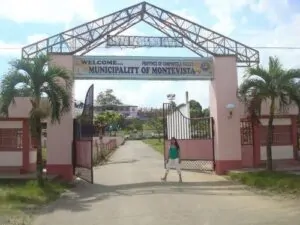
Montevista Image Showcase
Authentic verified photography capturing civic landmarks, community sports, and local destinations.



Custom Shirts, School Uniforms & Workwear for Montevista
RB Advertising (PHShirt) manufactures top grade sublimated sports jerseys, DepEd school uniforms, corporate polo shirts, event tees, and municipal safety vests for barangay councils, schools, cooperatives, and commercial businesses across Montevista and Davao de Oro. Custom apparel orders are fabricated at our Tagum City facility (Naungayan Building, Aala Road, Barangay Mankilam, Tagum City) and delivered daily directly to Montevista terminal via passenger van cargo.
Wholesale volume packages start at ₱320.00 (about $5.10 / €4.45 / £3.85) with official BIR registered receipts, digital mockups, and express Mindanao freight.
Production Facility: Naungayan Building, Aala Road, Barangay Mankilam, Tagum City • Hours: Mon to Sat, 8:30 AM to 5:00 PM (PHT)
Frequently Asked Questions
Key answers regarding Montevista demographics, history, travel routes, and municipal facts.