
Cagayan de Oro City: 80 Barangays, Districts & Regional Hub Guide
Known across the Philippines as the City of Golden Friendship, Cagayan de Oro is the regional administrative capital of Northern Mindanao (Region X) and the designated fourth metropolitan center in the country. Straddling the scenic Cagayan River as it flows into Macajalar Bay, this highly urbanized city unites 80 vibrant barangays across two legislative districts, blending historic Spanish-era poblacion squares, thriving IT and logistics corridors, and world-renowned whitewater river canyons.
The Gateway to Northern Mindanao on Macajalar Bay
Positioned along the central coast of Northern Mindanao, Cagayan de Oro serves as the natural crossroads between the agricultural plateaus of Bukidnon, the industrial corridor of Misamis Oriental, and the open sea lanes of the Bohol Sea.
Geographically nestled in the province of Misamis Oriental while remaining politically independent as a Highly Urbanized City, Cagayan de Oro spans 412.80 square kilometers. The city is bounded on the north by the deep waters of Macajalar Bay, to the east by the municipality of Tagoloan, to the west by the coastal town of Opol, and to the south by the high elevation provinces of Bukidnon (including Talakag, Baungon, Libona, and Manolo Fortich).
The geographic lifeline of the city is the historic Cagayan River (Rio de Oro), which originates from the high plateaus of Mount Kalatungan and Mount Kitanglad in Bukidnon. Flowing northward for approximately 90 kilometers, it bisects the city into two distinct halves before emptying into Macajalar Bay. This natural barrier establishes the boundary between the city's two legislative districts: District 1 on the West Bank and District 2 on the East Bank.
The city terrain rises from low-lying coastal alluvial plains near the bay to rolling hills, limestone bluffs, and forested plateaus exceeding 500 meters above sea level in southern upland barangays such as Dansolihon, Tignapoloan, and Besigan. Under the Coronas climate classification, Cagayan de Oro enjoys a Type III tropical climate, shielded from extreme typhoons by the protective mountain ranges of Central Mindanao.

Cagayan River Spine
Natural 90-kilometer waterway carving deep limestone canyons upstream, driving premier whitewater rafting routes, and dividing District 1 and District 2.
Macajalar Bay Coastline
Deep sheltered marine waters hosting the international Port of Cagayan de Oro, coastal trading terminals, passenger liners, and cold storage logistics.
Highland Plateau Foothills
Rolling southern hills connecting to Bukidnon pineapples, ancestral tribal domains of the Higaonon, eco-parks, and nature trekking circuits.
The 80 Barangays of Cagayan de Oro City
Cagayan de Oro is partitioned into two legislative districts encompassing 57 urban and 23 rural barangays. The Cagayan River serves as the definitive boundary separating the western growth sector from the eastern commercial and industrial core.
District 1 (West Bank)
24 Barangays • 290,913+ ResidentsDistrict 1 encompasses the rapid urban expansion frontier, prime educational campuses, regional military headquarters, and expansive highland barangays stretching toward Bukidnon and Iligan City.
Primary Urban & Commercial Centers
Upland Frontier & River Adventure Barangays
Expansive agricultural land, whitewater rafting put-in locations, and mountain ridge settlements:
District 2 (East Bank)
56 Barangays • 437,489+ ResidentsDistrict 2 houses the historic Spanish poblacion, the Misamis Oriental provincial government seat, the base seaport at Macajalar Bay, heavy industrial manufacturing corridors, and the Agora transit hub.
16 Non-Poblacion Growth & Industrial Barangays
40 Historic Downtown Poblacion Barangays
The walk-friendly heritage grid surrounding Plaza Divisoria, Gaston Park, San Agustin Metropolitan Cathedral, Xavier University, and City Hall:
Numbered Barangays 1 through 40: Barangay 1, Barangay 2, Barangay 3, Barangay 4, Barangay 5, Barangay 6, Barangay 7, Barangay 8, Barangay 9, Barangay 10, Barangay 11, Barangay 12, Barangay 13, Barangay 14, Barangay 15, Barangay 16, Barangay 17, Barangay 18, Barangay 19, Barangay 20, Barangay 21, Barangay 22, Barangay 23, Barangay 24, Barangay 25, Barangay 26, Barangay 27, Barangay 28, Barangay 29, Barangay 30, Barangay 31, Barangay 32, Barangay 33, Barangay 34, Barangay 35, Barangay 36, Barangay 37, Barangay 38, Barangay 39, and Barangay 40.
Top 12 Most Populous Barangays in Cagayan de Oro
Official Philippine Statistics Authority (PSA) and PhilAtlas Demographic Census Data
| Rank | Barangay Name | District | 2020 Population | City Share (%) | Primary Character & Economic Role |
|---|---|---|---|---|---|
| 1 | Carmen | District 1 | 77,756 | 10.67% | Most populous barangay; self-contained city-within-a-city with commercial districts, banks, and major public market. |
| 2 | Balulang | District 1 | 42,205 | 5.79% | Rapidly expanding riverside residential center with major subdivision communities along the Cagayan River. |
| 3 | Kauswagan | District 1 | 40,239 | 5.52% | Key highway junction connecting downtown to western coastal corridors; high density commercial and automotive retail. |
| 4 | Lapasan | District 2 | 39,234 | 5.39% | Transit pulse of CDO; home to Agora Eastbound Bus Terminal, coastal shopping malls, fruit terminals, and university campuses. |
| 5 | Bulua | District 1 | 35,397 | 4.86% | Western transportation hub housing the Bulua Westbound Bus Terminal, cargo logistics, and renowned handmade pottery center. |
| 6 | Camaman-an | District 2 | 35,238 | 4.84% | Vibrant residential valley nestled behind the provincial capitol and downtown hills with bustling local trade. |
| 7 | Canitoan | District 1 | 34,250 | 4.70% | Sprawling residential sector featuring masterplanned socialized housing communities and expanding commercial avenues. |
| 8 | Lumbia | District 1 | 31,504 | 4.33% | The Uptown growth frontier; former airport site now hosting major government regional agencies, upscale townships, and tech developments. |
| 9 | Bugo | District 2 | 31,229 | 4.29% | Industrial powerhouse hosting the Del Monte Philippines cannery, heavy manufacturing, coastal shipping, and gateway to Bukidnon. |
| 10 | Gusa | District 2 | 28,974 | 3.98% | Gateway to eco-tourism reserves; coastal residential neighborhoods leading up into the Malasag mountain ridges. |
| 11 | Iponan | District 1 | 27,521 | 3.78% | Western boundary barangay bordering Opol; thriving residential communities and artisanal ceramics workshops. |
| 12 | Tablon | District 2 | 24,578 | 3.37% | Eastern manufacturing spine housing food processing giants including Nestle Philippines, packaging plants, and warehouses. |
Poblacion Walkability Note: The 40 numbered barangays in District 2 compose the historic square grid laid out during the Spanish colonial era. Many of these downtown barangays have compact land areas under 15 hectares and smaller resident populations, but they experience daily daytime transient foot traffic exceeding 250,000 workers, students, legal professionals, and market shoppers.
City Governance & Institutional Structure
Cagayan de Oro operates under a Highly Urbanized City charter, providing administrative autonomy from the provincial government of Misamis Oriental while serving as the regional administrative hub for national line agencies across Region X.
Hon. Rolando "Klarex" A. Uy
Executive leadership directing city infrastructure modernization, social services, public health facilities, and transparent digital governance across all 80 barangays.
Hon. Jocelyn "Bebot" B. Rodriguez
Presiding officer of the 20th Sangguniang Panlungsod, steering progressive legislative policy, community welfare ordinances, and modern public market administration.
Hon. Lordan G. Suan
Congressional advocate for western CDO road networks, educational scholarships, healthcare access, and upland farm-to-market arterial connectivity.
Hon. Rufus B. Rodriguez
Senior national legislator authoring landmark charters for special economic zones, university system status acts, and Metro CDO metropolitan master plans.
Regional Government Capital at City Hall & Uptown
Cagayan de Oro hosts the regional offices of national government departments across Mindanao. The historic City Hall complex overlooks the Cagayan River beside Gaston Park in District 2, handling municipal licensing, revenue generation, and community development.
To relieve congestion in the downtown core, several regional offices have transitioned to the Uptown district in Barangay Lumbia, creating an emerging civic and administrative hub alongside Pueblo de Oro. Major medical institutions such as the Northern Mindanao Medical Center (NMMC) and J.R. Borja General Hospital provide tertiary healthcare across Northern Mindanao and Caraga.
Administrative Milestones
- June 15, 1950: Enactment of Republic Act No. 520, signed by President Elpidio Quirino, declaring Cagayan de Oro a chartered city and appending "de Oro" in honor of river gold panning traditions.
- 1983: Upgraded to a Highly Urbanized City (HUC), gaining complete administrative self-governance.
- NEDA Philippine Development Plan: Formally recognized as the fourth emerging metropolitan center (Metro Cagayan de Oro) alongside Manila, Cebu, and Davao.
The Rising 4th Philippine Metropolis
Ranked regularly by the National Competitiveness Council and PwC as one of the most competitive and business-friendly cities in the Philippines, Cagayan de Oro drives the regional trade, industrial manufacturing, logistics, and IT services of Northern Mindanao.
Port of Cagayan de Oro
Recognized as an international Green Port by the APEC Port Services Network. Located in Barangay Macabalan along Macajalar Bay, handling roll-on roll-off ferries, container cargo, and major shipping lines like Cebu-to-CDO passenger routes.
IT-BPO & Tech Hub
Designated as a premier Next Wave City and Top 10 Thriving IT-BPM Location in the Philippines. Hosts global outsourcing campuses, software firms, customer support centers, and high-speed fiber data corridors.
Mindanao Retail Giant
Home to the landmark Limketkai Center (a homegrown multi-hectare shopping complex), Centrio Ayala Mall, SM CDO Downtown Premier, SM City CDO Uptown, and Robinsons, drawing millions of shoppers across Region X.
Agro-Industrial Manufacturing & Logistics Corridor
Cagayan de Oro functions as the primary processing gateway for agricultural produce cultivated throughout Bukidnon and Central Mindanao. Barangay Bugo hosts the massive cannery and processing complex of Del Monte Philippines, exporting canned pineapple, juices, and packaged fruit worldwide.
Along the coastal highway in Barangay Tablon, heavy food manufacturing facilities such as Nestle Philippines produce consumer staples. Adjacent to the city in Tagoloan lies the PHIVIDEC Industrial Estate and the Mindanao Container Terminal (MCT), providing modern berths for international container vessels that connect CDO directly to Singapore, Kaohsiung, and regional Pacific trade lanes.
The cooperative sector is remarkably strong in CDO, hosting the national headquarters of the Massive Multipurpose Cooperative (MASS-SPECC) and First Community Cooperative (FICCO), making the city a recognized capital of cooperative banking in the Philippines.
Metro Cagayan de Oro Vision
Under NEDA's National Spatial Strategy, Metro Cagayan de Oro is projected to become Mindanao's primary gateway metropolis. The metropolitan master plan encompasses:
- Cagayan de Oro City: Commercial, educational, financial, and service center.
- Tagoloan & Villanueva: Heavy industrial manufacturing and deepwater container logistics.
- Laguindingan & Opol: International aviation corridor, coastal tourism, and transport connectivity.
- Manolo Fortich (Bukidnon): Agro-forestry, highland recreation, and fresh fruit production.
Whitewater Rafting Capital & Tourism Highlights
Celebrated by travel authorities including Traveloka, Expedia, Trip.com, and Wikivoyage, Cagayan de Oro is the undisputed Whitewater Rafting Capital of the Philippines, offering world-class rapids alongside pristine eco-parks, historical caverns, and living tribal sanctuaries.
Cagayan River Whitewater Rafting
The signature outdoor thrill of Mindanao. Features 14 to 21 thrilling rapids running through dramatic limestone canyons, spanning beginner runs from Cabula to advanced runs upstream in Dansolihon and Mambuaya.
Mapawa Nature Park
A 2,500-hectare pristine forest reserve located in the foothills of Barangay Cugman. Renowned for its multi-tiered waterfall river trek, cliff jumping from 25-foot ledges, horseback trails, and canopy zip-lines.
Gardens of Malasag Eco-Tourism
Nestled high on the hills of Malasag overlooking Macajalar Bay. Showcases traditional architecture, hand-weaving looms, music, and folkloric crafts of Northern Mindanao's 5 indigenous tribal groups.
Macahambus Cave & Gorge
Historic cavern that served as the fortified redoubt during the Battle of Macahambus Hill on June 4, 1900, where Kagay-anon revolutionary fighters defeated American forces, opening to a dramatic 130-foot gorge.
Gaston Park & Saint Augustine Cathedral
The historic civic cradle of the city where the first Catholic mission was founded by Augustinian Recollects in 1626. Gaston Park features lighted dancing musical fountains fronting the metropolitan cathedral.
Macasandig Boulevard & Museo de Oro
Walkers, joggers, and cyclists gather along the scenic Macasandig River Boulevard for afternoon breezes, while the nearby Museo de Oro preserves prehistoric artifacts from the Huluga Cave settlement.
Getting Around: The Motorela, Terminals & Seaport
As Northern Mindanao's primary transit node, Cagayan de Oro connects inter-island ferries, regional bus terminals, international air corridors, and its distinct homegrown public transport vehicle: the Motorela.
The Iconic Motorela (Since 1964)
The Motorela is the undisputed cultural icon of Cagayan de Oro. Invented and patented in 1964 by Kagay-anon craftsman Rafael Floirendo, the vehicle is a portmanteau of "motorized" and "caratella" (the Spanish horse-drawn carriage).
Built by extending a standard motorcycle frame into a covered passenger cabin accommodating 6 to 8 riders facing each other, the motorela is the everyday transit backbone throughout the 40 Poblacion barangays, Nazareth, Macasandig, and Carmen. With colorful hand-painted livery and low fares, riding a motorela along Corrales Avenue or Divisoria is an authentic Kagay-anon rite of passage.
Twin Eastbound & Westbound Terminals
Regional ground transport across Northern Mindanao and the entire island is coordinated through twin mega terminals situated at opposite flanks of the city:
- Agora Eastbound Terminal (Barangay Lapasan): Hub for Rural Transit and Bachelor Express buses serving Bukidnon (Malaybalay, Valencia), Davao City, General Santos, Butuan, Surigao, and Gingoog City.
- Bulua Westbound Terminal (Barangay Bulua): Hub for Super 5 and Rural Transit buses connecting westward to Iligan City, Marawi, Pagadian, Ozamiz, Dipolog, and Zamboanga City.
Laguindingan International Airport (CGY)
Located 46 kilometers west of Cagayan de Oro along the coastal national highway, Laguindingan Airport is Mindanao's second busiest airport.
Operated by modern airlines (Philippine Airlines, Cebu Pacific, AirAsia), the facility links CDO with frequent daily direct flights to Manila, Cebu, Clark, Iloilo, and Davao. Passenger shuttle vans and airport express buses depart directly from Centrio Ayala Mall and Bulua terminal.
Port of Cagayan de Oro (Base Port)
Situated in Barangay Macabalan on Macajalar Bay, the Port of CDO is a premier passenger and cargo hub. Multiple shipping companies provide scheduled RoRo ferry passenger sailings:
- 2GO Travel: Multi-deck passenger cruise ferries linking CDO to Manila and Cebu City weekly.
- Trans-Asia Shipping Lines: Daily overnight passenger and vehicular crossings on the popular Cebu-to-CDO route.
- Lite Ferries & Cokaliong: Frequent sea connections to Bohol (Jagna and Tagbilaran) and Cebu.
Culture, Higalaay Festival & Kagay-anon Flavors
The spirit of Cagayan de Oro is embedded in the word higala (friend in Cebuano). Warm hospitality, deep religious devotion, and distinct Northern Mindanao culinary traditions define the city's rich community life.
The Grand Higalaay Festival (Every August 28)
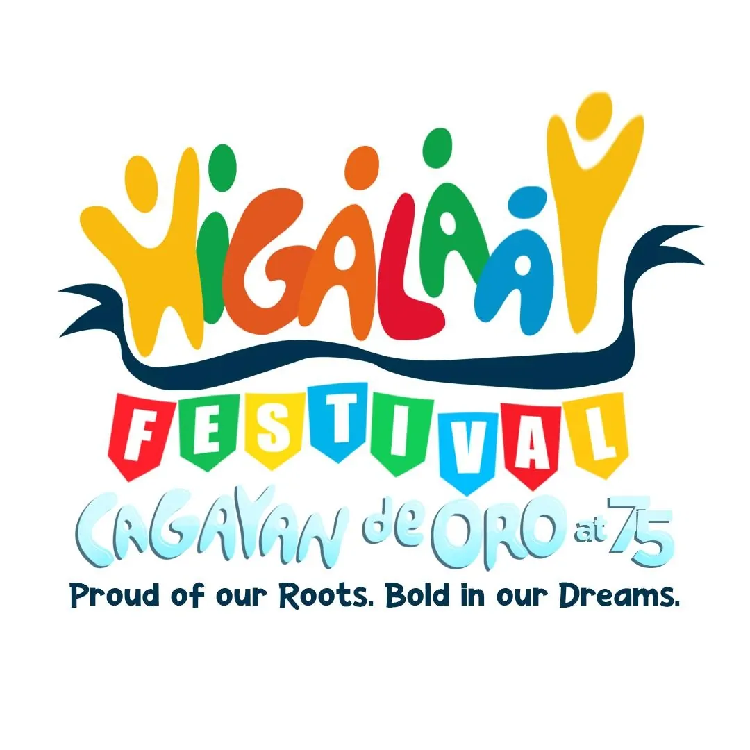
Every August, Cagayan de Oro celebrates the month-long Higalaay Festival in honor of its patron saint, Saint Augustine of Hippo. Derived from the native Cebuano term for friendship, Higalaay commemorates the city's identity as the City of Golden Friendship.
The festival features a vibrant calendar of events including the Street Dancing Competition, the Civic-Military Parade, the Float Parade of Golden Floats, the Kagay-an Festival Marathon, miss Cagayan de Oro pageants, and the fluvial procession of the image of Saint Augustine along the Cagayan River from Macasandig down to the cathedral.
Kagay-anon Gastronomy: Sinuglaw & Pastel
Cagayan de Oro's signature culinary creation is Sinuglaw, a harmonious marriage of two Filipino staples: sinugba (charcoal-grilled pork belly) and kinilaw (fresh raw fish ceviche). The dish is cured in spiced coconut vinegar, freshly squeezed suwa (native local citrus), ginger, onions, bird's eye chilies, and the essential astringent shavings of the indigenous tabon-tabon nut to balance the acidity and tenderize the fish.
Visitors also savor tender Kagay-anon cured corned beef, artisan roast beef sandwiches along Corrales Avenue, and boxes of sweet Vj-AND-EP Pastel, the beloved soft bun filled with decadent yema custard that originated in nearby Camiguin and became an essential CDO pasalubong staple.
Custom Uniforms, Polos & Jerseys for Cagayan de Oro
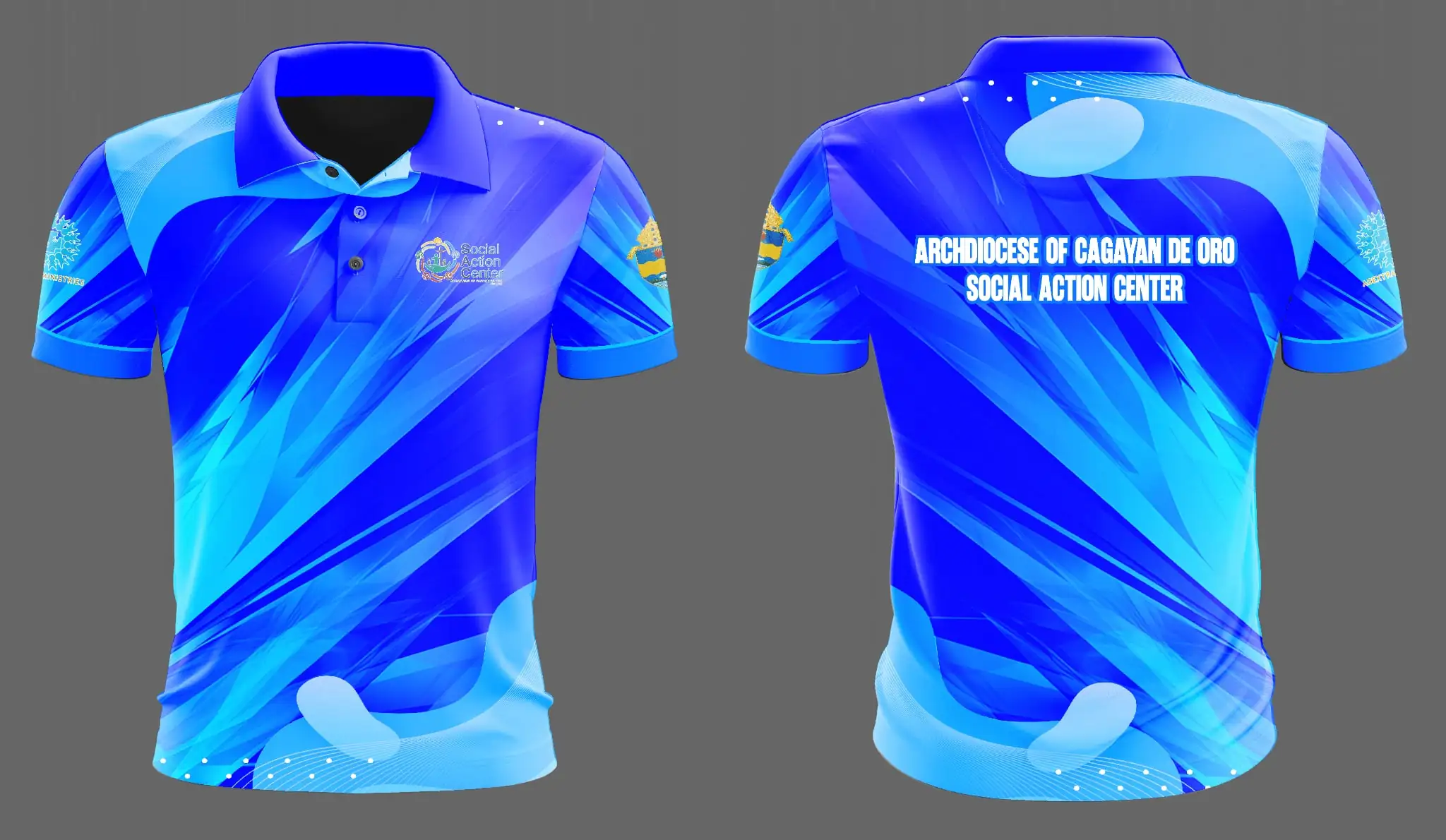
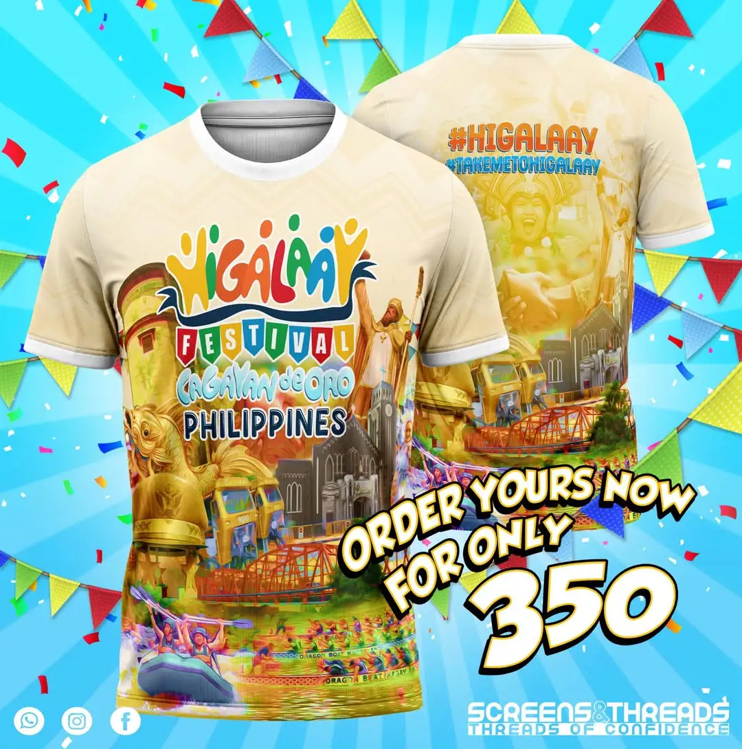
RB Advertising and PHShirt manufacture and supply premium custom sublimation jerseys, corporate polo shirts, adventure quick-dry apparel, and institutional uniforms delivered directly across all 80 barangays of Cagayan de Oro.
Adventure Rashguards & Tech Shirts
Quick-dry UV50+ performance fabric engineered for river rafting guides, kayak instructors, and outdoor adventure staff along the Cagayan River.
Corporate Polos & Tech Jackets
Embroidered corporate pique polos and comfortable office windbreakers for BPO companies, universal banks, and port freight forwarders in Lapasan and Macabalan.
School PE & Team Uniforms
Breathable dri-fit PE shirts, varsity basketball sets, and department shirts tailored for Xavier University, USTP, Liceo, and PHINMA COC.
80 Barangays & SK Uniforms
High-durability institutional t-shirts, barangay tanod uniforms, SK athletic jerseys, and official disaster response gear delivered directly to all 80 barangays.

Order Custom Apparel for Cagayan de Oro
Reach out directly to discuss fabric swatches, sizing guides, digital mockups, and bulk turnaround times through our canonical contact channels:
Frequently Asked Questions About Cagayan de Oro City
Essential answers regarding barangay divisions, geographic boundaries, travel routes, and business operations in Cagayan de Oro.
How many barangays are there in Cagayan de Oro City?
Cagayan de Oro City has a total of 80 barangays. These are divided into two legislative districts: District 1 on the West Bank of the Cagayan River with 24 barangays, and District 2 on the East Bank with 56 barangays (which includes the 16 non-poblacion growth barangays and the 40 numbered Poblacion barangays).
What is the largest barangay in Cagayan de Oro?
In terms of population, Barangay Carmen is the largest barangay with 77,756 residents recorded in the 2020 Census, accounting for over 10.6% of the city total. In terms of land area, southern upland rural barangays such as Dansolihon, Tignapoloan, and Besigan encompass the largest geographic territories extending into the Bukidnon foothills.
Why is Cagayan de Oro called the City of Golden Friendship?
The moniker reflects both the historical gold panning along the Cagayan River and the exceptional warmth, hospitality, and welcoming nature of the local Kagay-anon people. The Cebuano word higala (friend) is celebrated citywide during the annual Higalaay Festival every August.
How does the Cagayan River divide the city?
The Cagayan River (Rio de Oro) flows 90 kilometers northward from Bukidnon down into Macajalar Bay, serving as the natural spine of the city. District 1 lies on the western side of the river (Carmen, Lumbia, Bulua, Kauswagan, Balulang), while District 2 lies on the eastern side (Poblacion, Lapasan, Nazareth, Macasandig, Bugo, Tablon). Several major bridges connect the two districts, including the Ysalina Bridge, Kagay-an Bridge, Rodelsa Circle Bridge, and Puntod-Kauswagan Bridge.
What is a motorela and where did it originate?
The Motorela was invented in Cagayan de Oro in 1964 by local craftsman Rafael Floirendo. It is a distinct motorized carriage combining a motorcycle with a covered cabin seating 6 to 8 passengers facing inward, designed to navigate the narrow downtown street grid of the 40 Poblacion barangays and neighboring residential areas.
When is the best time for whitewater rafting in Cagayan de Oro?
Whitewater rafting on the Cagayan River runs year-round due to consistent water flow from Bukidnon watersheds. For faster currents and higher adrenaline Class III and IV rapids, the wet season months from July to December offer thrilling river conditions, while the dry season from January to June provides clear waters ideal for beginners.
How are custom uniforms shipped to Cagayan de Oro from PHShirt?
Bulk apparel orders are dispatched via trusted freight cargo lines to the Agora Eastbound Terminal or Bulua Westbound Terminal, as well as door-to-door couriers (LBC, J&T, AP Cargo) delivering directly to offices, universities, schools, and barangay halls across Cagayan de Oro.